
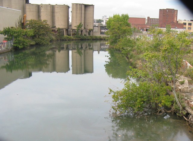

Photo By Eymund Diegel
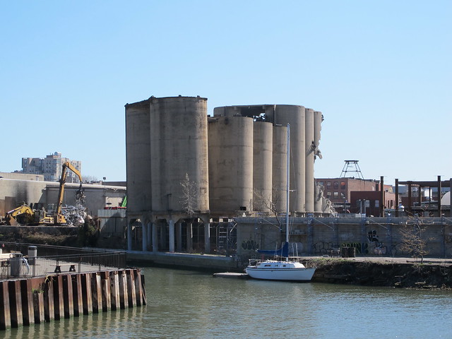

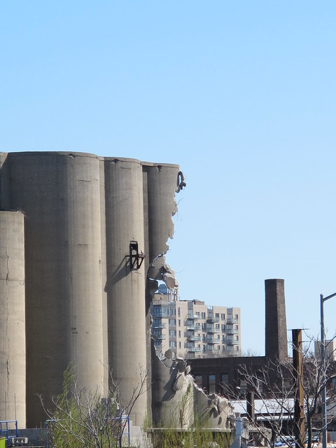
Gowanus, as we know it, is disappearing before our eyes.
Barely days after the demolition of the iconic silos at Carroll Street on the shores of the Gowanus Canal, comes news that the Burns Brothers coal pockets are in the process of being torn down. The photo above was taken yesterday by my friend Eymund Diegel. By today, Friday, the concrete silos opposite Whole Foods at 6th Street between 2nd and 3rd Avenue will be history.
Eymund also sent along the kite photography pictures below, which he took in 2012.
was used for domestic heating and cooking, and it later was burned to generate electricity. Coal pockets
were used to move and store the coal from barges on the canal to wagons and, later, trucks for delivery.
The eight pockets closest to the water were built between 1915 and 1924, and by 1938 there were 10 more. These 40- and 50-foot tall structures are no longer used today but remain as relics of the canal’s crucial transportation role.
As Eymund adds, "the pockets were an intelligent way of reducing the area needed for the coal piles. I understand the pockets were also used for industrial minerals / oxides after their coal use. The coal would come from Pennsylvania via the newly built barge and canal system."
The Burns Brothers Coal Pockets were in operation at 2nd Avenue on the banks of the Goawnus Canal from 1915 to 1938. According to the Historic District Council's Guide to Gowanus:
Coal was one of the major freights shipped on the canal in the 19th and 20th centuries. Initially, coalwas used for domestic heating and cooking, and it later was burned to generate electricity. Coal pockets
were used to move and store the coal from barges on the canal to wagons and, later, trucks for delivery.
The eight pockets closest to the water were built between 1915 and 1924, and by 1938 there were 10 more. These 40- and 50-foot tall structures are no longer used today but remain as relics of the canal’s crucial transportation role.
As Eymund adds, "the pockets were an intelligent way of reducing the area needed for the coal piles. I understand the pockets were also used for industrial minerals / oxides after their coal use. The coal would come from Pennsylvania via the newly built barge and canal system."
The image below shows the Scranton Coal mine in the early 1900s (via the Paul Ivazes archives)

And here is a historic photo of Gowanus Bay Manufacturing Gas Plant coal barges at Navy Pier Grain Terminal provided by Eymund.

Here is a screen capture of an areal from Bing.com/maps circa 2010

The two kite photographic images below were taken by the Gowanus Canal Conservancy's Gowanus Low Altitude Mapping Program in 2012.


The demolitions that are now underway no doubt illustrate the incredible pressure Gowanus is under to change from a mostly manufacturing area to one that will allow more housing.
Here is an amazing article by friend and photographer Nathan Kensinger on the transformations in this unique neighborhood, which was just published on Curbed:
Visiting the Gowanus Canal's Under-Transformation 'Wild West'


.JPG)


