

The Gowanus Canal yesterday afternoon, before the storm
photo credit Mary P.

Before the storm
Photo credit: Mary P.

The Gowanus Canal last night
photo credit: Lisanne at Found In Brooklyn
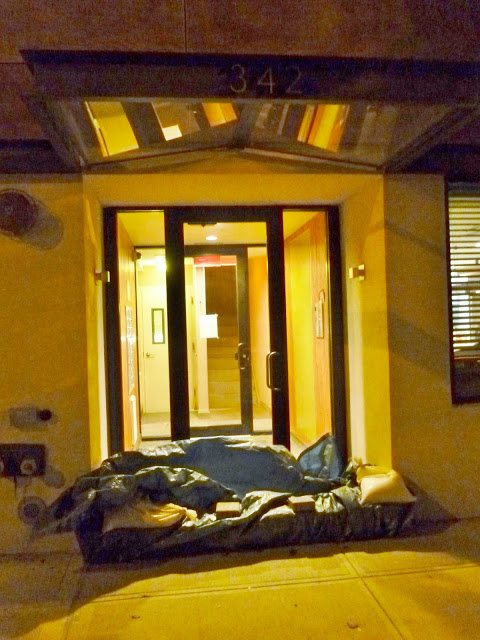
Sandbags in front of The Satory on Bond Street
photo Credit: Lisanne at Found In Brooklyn

photo Credit: Lisanne at Found In Brooklyn
For the second year in a row, New York City is feeling the effects of a hurricane and the flooding that accompanies these massive storms. While Irene caused plenty of problems last August, it would appear that Sandy will be the "most catastrophic event in our lifetime." Some predictions show that this particular storm will hammer the coast with 11 foot waves. In our immediate area, Red Hook and Gowanus are particularly affected since they are located in Flood Zone A and experience flooding on a regular basis.
It is also for the second time in a bit more than a year that residents of these two neighborhoods have been under mandatory evacuation orders.
In preparation for flooding, sandbagging in Gowanus began a few days ago. The photos above were taken in front of The Satori on Bond Street and Union Street by my good friend Lisanne and posted on her blog Found In Brooklyn last night. This building as well as Third and Bond had to pump water out of their basement after Irene.
The photos below were taken this morning by friend Steve Miller. Steven remarks: "At 9:45 this morning we ate at the levels of last years Irene. The highest levels expected for Sandy at at approx 8pm tonight."
This will not be pretty, especially since, as we know, the Gowanus Canal has been declared a Superfund Site because of the toxic sludge at the bottom of the canal. The churning winds of a hurricane will most certainly stir up the thick black muck and deposit it on the shores.
In addition, the City Of New York still uses the Gowanus as a cess pool by allowing Combined Sewer Overflow to discharge into the waterway when its antiquated sewer system is overloaded (See video here). Can you imagine how much sewer will flow into the canal during this storm?

Gowanus at 9:30 Am this morning
photo credit: Steven M.

photo credit: Steven M.
Hurricane Sandy And Lightstone's Proposed Development On Bond Street
Lightstone's planned 700-unit rental building is right on the canal and in Zone A, which has just been evacuated for the second time in 14 months.

Lightstone Group's proposed 700-unit project along the Gowanus


Here are some pictures taken of First and Bond Streets at 10 Am this morning, 2 hours after high tide. This is exactly the spot of that beautiful Lightstone graphic above.

photo credit: Carl Teitelbaum

photo credit: Carl Teitelbaum
And here is one taken of the site as seen from the Carroll Street bridge at 10 Am today

photo credit: Margaret Maugenest


I will continue to update this post and blog during the storm. Please send me your photos and updates, but most importantly, stay safe.


.JPG)


1 comment:
This is a continual reminder to be prepared for the worst.
Post a Comment