
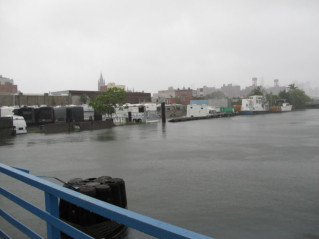
Gowanus Canal overflowing its banks during Hurricane


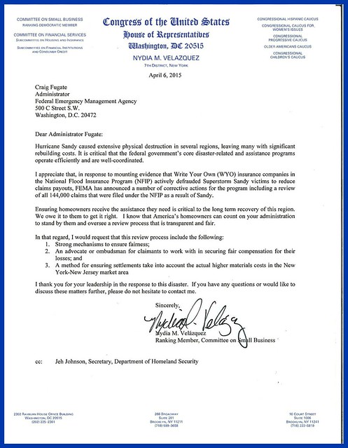
Congresswoman Nydia Velázquez’s letter to the FEMA Administrator regarding
the National Flood Insurance Program and its process for reopening claims.
In the past few days, the Federal Emergency Management Agency (FEMA) sent out letters regarding updated flood maps for New York City to all property owners in or near the Special Flood Hazardous Area newly identified by the federal agency.
The Agency encourages everyone to identify their property's flood risk by checking the Preliminary Flood Insurance Rate Maps. The maps can be accessed here and here.
In the letter, FEMA stresses that the maps are only preliminary. A public comment and appeal period began on March 31st, 2015 and will continue until June 28th, 2015. During this period, homeowners can challenge FEMA's new maps by sending technical and/or scientific data regarding their individual property.
After FEMA evaluates all challenges and appeals, the new maps will be incorporated and flood insurance purchase requirements will go into effect.
Above also please fine Congresswoman Nydia Velázquez’s letter to the FEMA Administrator Craig Fugate regarding the National Flood Insurance Program and its process for reopening claims.
Her office has been very helpful in this matter.
A few days ago, I was contacted by Antony Gemmell, Staff Attorney for New York Legal Assistance Group, a non-profit organization which provides free legal services to people who were impacted by Superstorm Sandy.
Gemmell let me know that New York Legal Assistance Group "offers advice and representation on a wide range of legal issues related to Sandy, including flood insurance."
Please avail yourself of the organization's services by contacting NYLAG's Storm Response Unit (SRU) client intake team at (212) 584-3365 or stormhelp@nylag.org.
If you received the FEMA letter because your property is either is zone A or Zone X, you need to take the time to understand what all of this will mean. This has some very important ramifications beyond getting flood insurance.
Read more
The Agency encourages everyone to identify their property's flood risk by checking the Preliminary Flood Insurance Rate Maps. The maps can be accessed here and here.
In the letter, FEMA stresses that the maps are only preliminary. A public comment and appeal period began on March 31st, 2015 and will continue until June 28th, 2015. During this period, homeowners can challenge FEMA's new maps by sending technical and/or scientific data regarding their individual property.
After FEMA evaluates all challenges and appeals, the new maps will be incorporated and flood insurance purchase requirements will go into effect.
Clearly, this is an important issue for homeowners in both Gowanus and Red Hook. The information created by FEMA has generated more questions and has left many owners confused, as they are trying to navigate through this process in a relatively short time period.
FEMA has held a community meeting in Red Hook two weeks ago. After residents called for a similar meeting in Gowanus, FEMA and the City have just announced that they will be happy to organize an informational meeting in the Gowanus/ Carroll Gardens area.
That is good news. I will be posting information on the meeting as soon as a date has been set, so stay tuned.
Her office has been very helpful in this matter.
A few days ago, I was contacted by Antony Gemmell, Staff Attorney for New York Legal Assistance Group, a non-profit organization which provides free legal services to people who were impacted by Superstorm Sandy.
Gemmell let me know that New York Legal Assistance Group "offers advice and representation on a wide range of legal issues related to Sandy, including flood insurance."
Please avail yourself of the organization's services by contacting NYLAG's Storm Response Unit (SRU) client intake team at (212) 584-3365 or stormhelp@nylag.org.
If you received the FEMA letter because your property is either is zone A or Zone X, you need to take the time to understand what all of this will mean. This has some very important ramifications beyond getting flood insurance.




.JPG)


